Cloud Formation Basics
At the heart of cloud creation lies water vapor, the invisible moisture continuously evaporating from oceans, rivers, and lakes into the air. However, for clouds to form, this vapor needs a starting point to condense upon, known as cloud condensation nuclei. These nuclei are tiny particles floating in the air, made from things like dust, salt from ocean spray, or even particles from wildfires. They're about one-millionth of a meter in size, yet they play a huge part in making clouds a reality.
For these nuclei to transform water vapor into droplets (or ice crystals in colder conditions), two conditions must be met: the right temperature and 100 percent relative humidity. This is when the air is fully saturated, meaning it can't hold any more moisture at that temperature. When the air cools down to its dew point (the temperature where it becomes saturated), the water vapor clings to the nuclei, turning into tiny droplets or ice crystals we eventually see as clouds.
These infant clouds don't just appear anywhere. The Earth's atmosphere is an ever-moving layer, where temperature and humidity constantly change. This dynamic plays a role in why we see clouds form abruptly or vanish just as quickly. Air movements, temperature fluctuations, and varying moisture levels all contribute to this changing skyscape.
Understanding cloud formation is not just about knowing how rain or snow is on its way. It's also appreciating a vital process in our climate system. Clouds act like Earth's thermostat, reflecting sunlight away to cool the planet or trapping heat to keep it warm. It shows us the delicate balance in nature and how interconnected everything is, from a single droplet of water to the vast climate systems.
Clouds aren't just there to forecast weather; they're a vital piece of Earth's complex environmental puzzle.
Types of Clouds and Their Identification
Let's delve into distinguishing the ten primary cloud types classified in the World Meteorological Organization's International Cloud Atlas. These clouds are fascinating to observe and understanding them can give us insights into the weather and atmospheric conditions.
High-Level Clouds
Starting at the top, we encounter Cirrus (Ci) clouds. These wispy, feathery formations, often likened to strands of hair, are found at altitudes above 20,000 feet. Cirrus clouds, composed entirely of ice crystals, signal fair weather but can indicate that a change in weather is on the way.
Cirrocumulus (Cc) clouds are much smaller and appear as white patches or sheets. They're sometimes described as looking like the scales of a fish or rows of cotton balls. This cloud type is not very common and often signals moisture in high layers of the atmosphere.
Cirrostratus (Cs) clouds form a thin, veil-like layer that covers the sky, sometimes causing a halo effect around the sun or moon. If you see these clouds blanket the sky, prepare for a change in the weather, as these generally precede rain or snow storms.
Mid-Level Clouds
Altocumulus (Ac) clouds, appearing as gray or white layers with patches, ripples, or rolls, sit at mid-level altitudes ranging from 7,000 to 20,000 feet. These clouds can indicate the approach of a thunderstorm in humid summer weather, especially if they thicken and lower into the sky.
Altostratus (As) clouds create a uniform, blue-gray or white sheet over the sky, often obscuring the sun. While they don't produce heavy rainfall, you might get light drizzle or snow from these clouds. A thickening altostratus layer may signal an approaching storm.
Nimbostratus (Ns), the chief rainmakers, form a dark, thick layer completely blocking the sun or moon. If you encounter these clouds, chances are you're in for some prolonged rainfall or snowfall.
Low-Level Clouds
Familiar Cumulus (Cu) clouds look like fluffy, white cotton balls with flat bases. While they might take on various shapes, these clouds generally indicate pleasant weather. However, if you see them growing vertically, this could mean a thunderstorm is developing.
Stratocumulus (Sc) form in low, lumpy layers covering the sky in gray or whitish patches. Although they rarely bring rain, their presence hints at a change in weather patterns.
Stratus (St) clouds lay down a layer of gray across the sky. These low clouds may bring light mist or drizzle. It's like seeing the day through a soft gray filter—moody but not significantly wet.
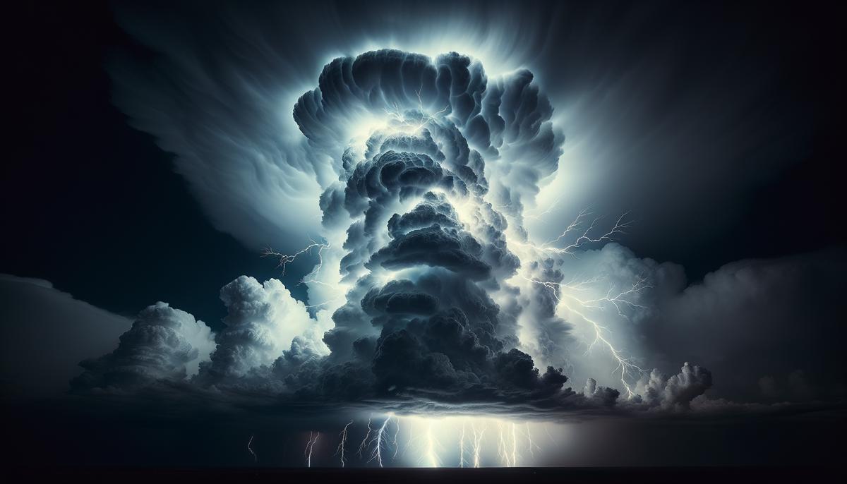
Cumulonimbus (Cb) are the giants of the cloud family. Extending from low to high altitudes, these towering clouds are responsible for heavy thunderstorms complete with lightning and potentially severe weather conditions, including hail and tornadoes.
Learning to identify these ten types of clouds unlocks a deeper understanding of our atmosphere and its dynamics. Over time, distinguishing between them becomes intuitive. Whether you're a casual cloud gazer or an aspiring meteorologist, remembering these classifications can deepen your appreciation for the constant changes playing out above us.

Clouds’ Role in Weather and Climate
In the vast, ever-changing stage of our sky, clouds play a pivotal role not only in painting the scenery but also in choreographing the weather and climate dramas that unfold over our heads each day. As we've seen, clouds come in various shapes and sizes, each type performing a unique function in our atmospheric system. But how do these floating marvels actually influence our weather and the broader climate? Let's dive deeper into the mechanisms at play.
Clouds can impact local weather patterns. Imagine a hot, sunny day; suddenly, dark cumulonimbus clouds roll in. Before you know it, a thunderstorm erupts. These towering clouds are capable of producing not only rain but lightning, thunder, and even severe events like hail or tornadoes. On the other hand, a chilly morning that starts with a blanket of stratus clouds can hold back the sunrise, keeping temperatures cooler than they might otherwise be.
On a cold night under a clear sky, without cloud cover to act as a blanket, the Earth's surface cools quickly, leading to frost or significantly lower temperatures. Cloud cover during the night can trap heat, preventing it from escaping back into space, thus keeping our nights warmer than they would be under clear sky conditions.
Clouds also play a major role in our climate. With the power to reflect sunlight back into space, clouds act as Earth's sunshade, helping to cool our planet.1 Yet, they also have the ability to trap heat, keeping the Earth warm. This dual role is a delicate dance in the Earth's climate system, where the balance between cooling and warming influences global temperatures and climatic conditions.
Clouds are a vital piece in the puzzle of Earth's water cycle. They ferry water from one part of the globe to another and then release it as precipitation – rain, snow, sleet, or hail. This precipitation contributes to maintaining ecosystems, refilling reservoirs, and irrigating crops.
Whether it's the gentle drizzle from stratus clouds or the dramatic thunder from cumulonimbus giants reaching high into the sky, clouds have a profound influence on our planet's wellbeing. Each droplet or ice crystal plays its part in the grand climatic ballet above us.
In essence, clouds are not merely spectators in the theater of our atmosphere; they are active participants in shaping weather patterns and regulating temperatures. Their role extends beyond creating picturesque sunsets or foreboding stormy skies. Clouds contribute fundamentally to Earth's water cycle and climate regulation, making them indispensable to understanding our planet's environmental health.
As we gaze up at the ever-changing canvas of the sky, let's appreciate the profound impact these ethereal formations have on our daily lives and the Earth's delicate balance. The study of clouds is not just a scientific pursuit; it's a window into understanding the intricate workings of our planet and our place within it.
- Boucher O, Randall D, Artaxo P, et al. Clouds and Aerosols. In: Climate Change 2013: The Physical Science Basis. Contribution of Working Group I to the Fifth Assessment Report of the Intergovernmental Panel on Climate Change. Cambridge University Press; 2013.
Writio: AI content writer tracking google ranking. This article was written by Writio.
Leave a Reply